Cartography (map making) is an ancient process that has been given a modern makeover with 3D modeling. You’ve seen 3D maps before. Most national parks, like Zions, have them. After canyoneering through the Subway, and walking through the Narrows, you went to the visitors center to refuel. Everyone gathered around the map and charted the trip they just finished. A lot of the map was smoothed over, and the large mountain features you just passed through aren’t as distinguishable. But you still get the overall idea of where you were.
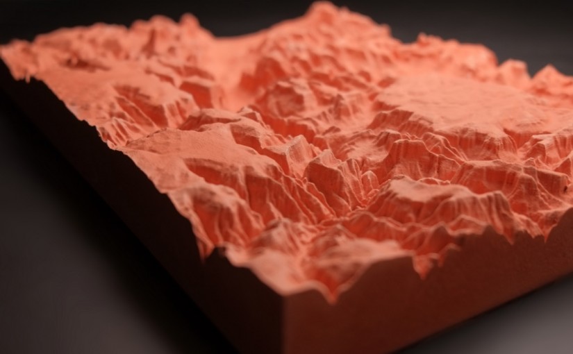
Meet CreoTrē, a company that uses the newest 3D technology and their own unique molding process that provides as much detail as possible into every map. They aren’t just making incredibly accurate 3D maps, they’re making art.

Shop Top of the Tetons
Most 3D maps use a plastic sheet that forms over a mold. The overall structure is there, but a lot of the fine details get lost in the process. CreoTrē pours a liquid into the mold and by doing so is able to preserve the details you want when you’re planning your next trip. Each mold is hand finished. The maps are made with either synthetic stone, cheaper but a better look, or rugged plastic, more expensive but very durable and portable.
Each mold is based on USGS maps (United States Geological Survey), which are the most accurate. All CreoTrē maps are made in the USA and, with CampSaver, call Logan, UT home. The new company is made up of three people: Eric Eliason, a USU adjunct professor, Brad Janssen, a landscape architect, and Liz Hart, a USU art graduate.
They plan on making more mountain ranges in the future but in the mean time here’s their selection that we carry.

Shop Grand Tetons Medium
Shop Grand Tetons Large

Shop Zion Canyon

Shop Angels Landing